Interactive atlas of early printing
Posted on September 2nd, 2009 by steve
If you’re wondering why Type Daily says ‘since 1455’ up top . . . this historical atlas will fill in some of the blanks.
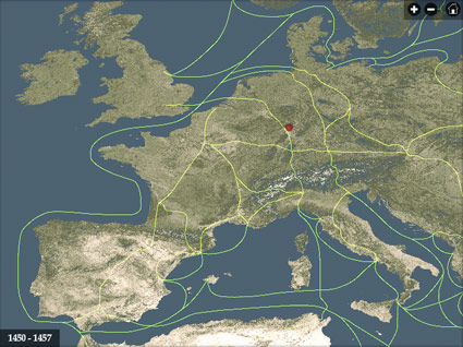
After Johann Gutenberg did his thing, the technology of printing spread across Europe in just around 50 years.
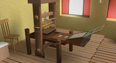
This interactive map from the University of Iowa charts its progress – with timeline, zoom features, trade routes, locations of paper mills and more. Also included is a briefly animated model of what we know of Gutenberg’s press.


[…] this page was mentioned by Justin Knopp (@typoretum), steve mehallo (@mehallo) and others. […]